| Bend | |
|---|---|
| |
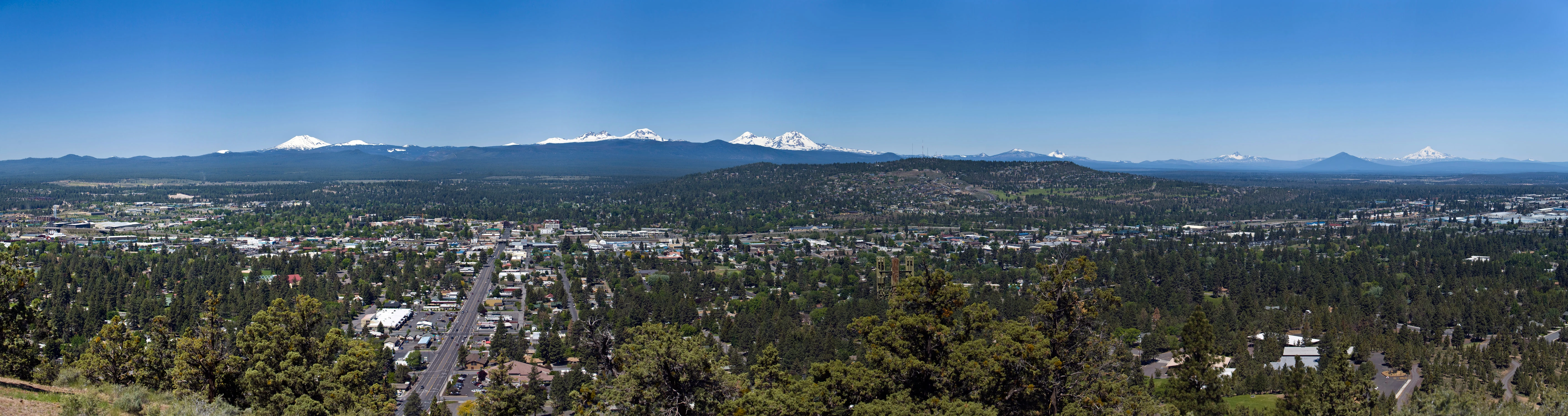
| Panorama of Bend, looking west from Pilot Butte. | |
| General Information | |
| Website: | www.ci.bend.or.us |

| |
| Government | |
| County: | Deschutes County |
| Mayor: | Jim Clinton |
| Geography | |
| Total Area: | 33.27 sq mi (86.17 sq km) [1] |
| Land: | 33.01 sq mi (85.50 sq km) |
| Water: | 0.26 sq mi (0.67 sq km) |
| Elevation: | 3623 ft (1104.3 m) |
| Population | |
| Demonym: | Bendite [2][3] |
| Geocodes | |
| ZIP Code(s): | 97701, 97702, 97707, 97708, 97709 |
| Area Code(s): | 458, 541 |
| FIPS Code: | 41-05800 [4] |
| GNIS ID: | 1137914 [5] |
| Twin cities | |
Bend is a city in and the county seat of Deschutes County. [13] It is the principal city of the Bend, Oregon Metropolitan Statistical Area. Bend is Central Oregon's largest city, and despite its modest size, is the de facto metropolis of the region, owing to the low population density of that area. Bend recorded a population of 76,693 at the time of the 2010 U.S. Census,[14] up from 52,029 at the 2000 census. The estimated population of Bend as of 2012 is 79,109.[15]
Bend's metro population was estimated at 170,705 as of July 1, 2009.[16][17] The Bend MSA is the 5th largest metropolitan area in Oregon.
Bend is located on the eastern edge of the Cascade Range along the Deschutes River. Here the Ponderosa Pine forest transitions into the High Desert, characterized by arid land, junipers, sagebrush, and bitter-brush. Originally a crossing point on the river, settlement began in the early 1900s. Bend was incorporated as a city in 1905. Economically, it started as a logging town but is now identified as a gateway for many outdoor sports, including mountain biking, fishing, hiking, camping, rock climbing, white-water rafting, skiing, and golf.
History[]
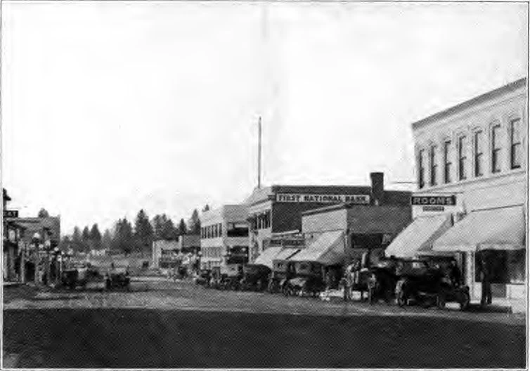
Downtown Bend circa 1920.
The name Bend was derived from "Farewell Bend", the designation used by early pioneers to refer to the location along the Deschutes River where the town was eventually platted, one of the few fordable points along the river.
For at least 12,000 years, until the winter of 1824, the Bend area was known only to Native Americans who hunted and fished there. That year, members of a fur trapping party led by Peter Skene Ogden visited the area. John C. Frémont, John Strong Newberry, and other Army survey parties came next. Then pioneers heading farther west passed through the area and forded the Deschutes River at Farewell Bend.
Constructed in May 1901, the Pilot Butte Development Company's little plant was the first commercial sawmill in Bend. The original location was at the rear of the Pilot Butte Inn of later years. Steidl and Reed also set up a small mill in Bend in 1903. This was on the Deschutes River just below the Pioneer Park area. The mill was operated by water power.[18] A small community developed around the area, and in 1904, a city was incorporated by a general vote of the community's 300 residents. On January 4, 1905, the city held its first official meeting as an incorporated municipality, appointing A. H. Goodwillie as the first mayor. The settlement was originally called "Farewell Bend", which was later shortened to "Bend" by the U.S. Postal Service.
In 1910, Mirror Pond was created by the construction of the Bend Water, Light & Power Company dam on the Deschutes River in Bend. The dam provided the city with its initial source of electricity. The dam has been owned by Pacific Power since 1926 and still produces electricity that supplies approximately 200 Bend households.[19] In 1916, Deschutes County was formed from the western half of Crook County and Bend was designated as the county seat. In 1929, Bend amended the charter and adopted the council-manager form of government.
Geography[]


_(desD0054b).jpg)
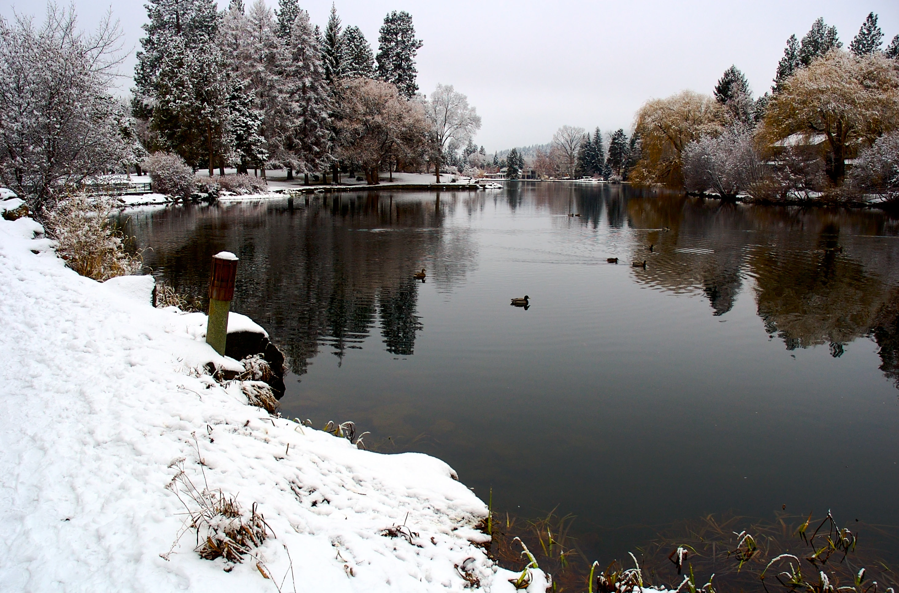
Mirror Pond from Drake Park during autumn.

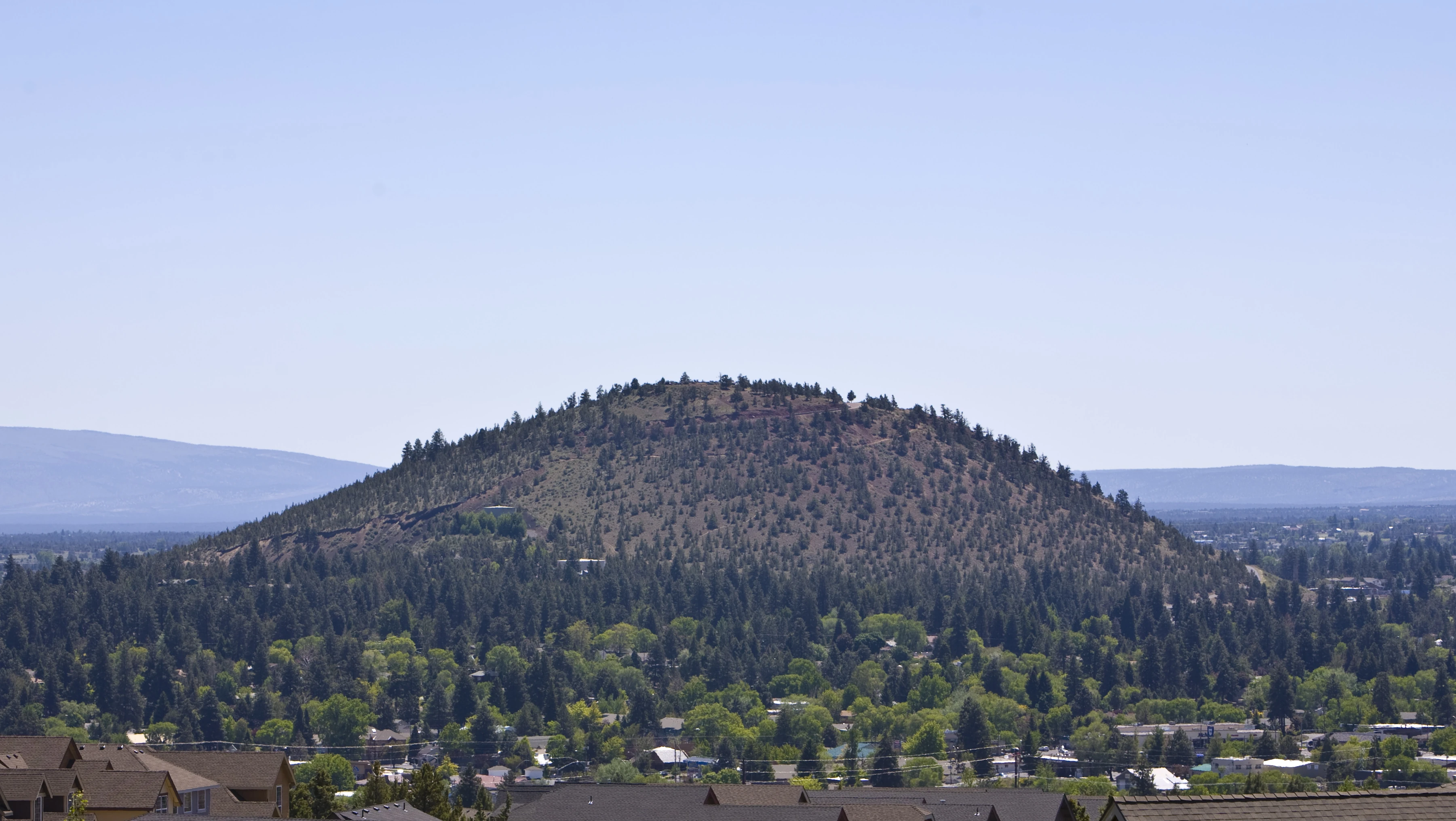
Pilot Butte.

Mirror Pond from Drake Park during winter.
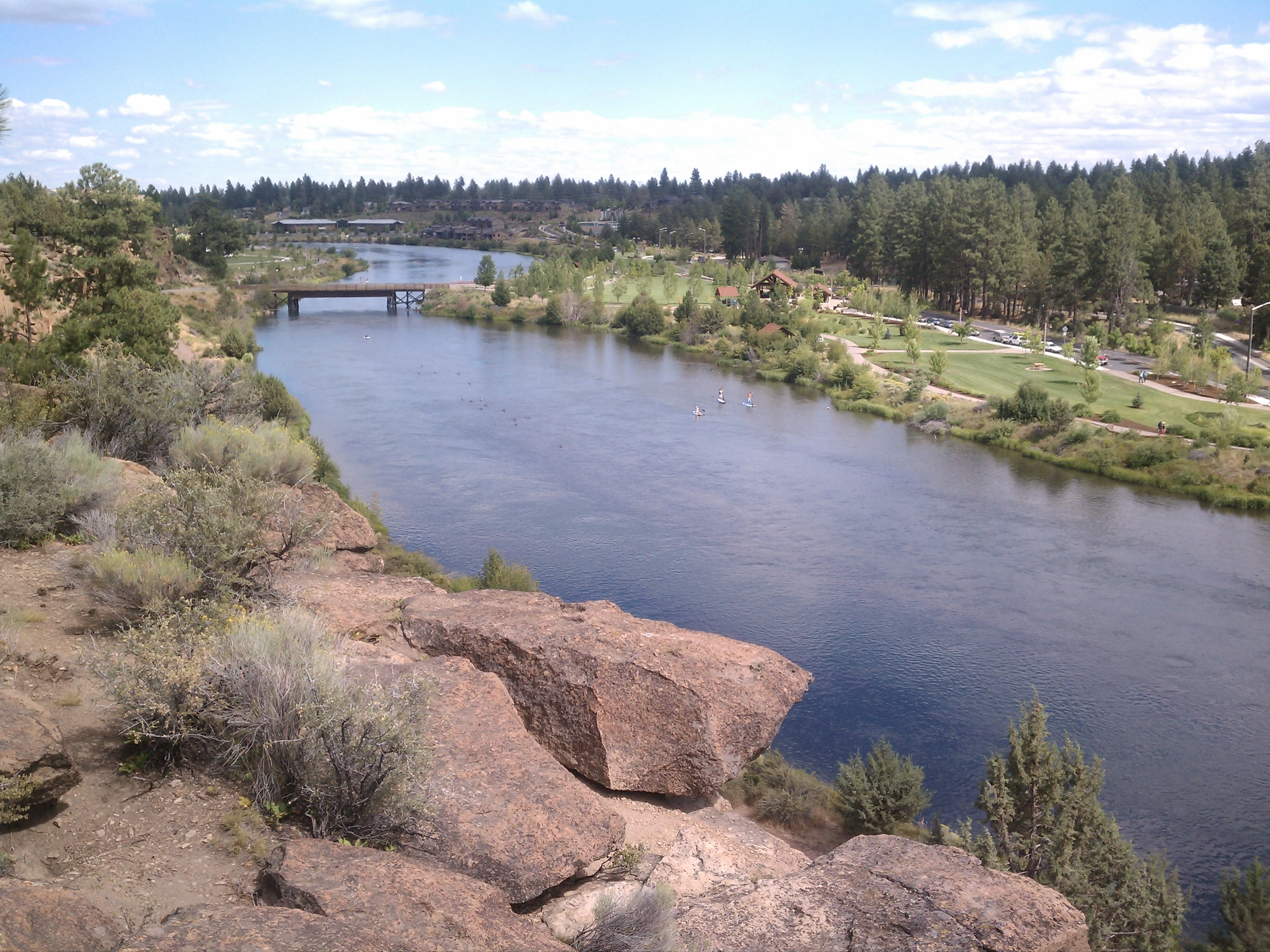
Bend sits on the boundary of the Eastern Cascades Slopes and Foothills, a Level III ecoregion designated by the United States Environmental Protection Agency (EPA) in Oregon, Washington, and California, and the Deschutes River Valley, a Level IV ecoregion within the Blue Mountains Level III ecoregion.[20] The Deschutes River runs though Bend where it is dammed forming Mirror Pond.[19] Bend's elevation is 3,623 feet (1,104 m).[21]
According to the United States Census Bureau, the city has a total area of 33.27 square miles (86,168,904.43 sqkm), of which, 33.01 square miles (85,495,507.52 sqkm) is land and 0.26 square miles (673,396.91 sqkm) is water.[1]
Inside the city limits is Pilot Butte State Scenic Viewpoint, an old cinder cone. Bend is one of three cities in the continental United States (with Portland, Oregon and Jackson, Mississippi) to have an extinct volcano within its city limits.[22] It is reached by U.S. Route 20.
A lesser known characteristic of Bend, the Horse Lava Tube System enters and borders the eastern edge of the city.[23][24]
Just south of Bend is Newberry National Volcanic Monument on U.S. Route 97.
Climate[]
| Bend, Oregon | ||||||||||||||||||||||||||||||||||||||||||||||||||||||||||||
|---|---|---|---|---|---|---|---|---|---|---|---|---|---|---|---|---|---|---|---|---|---|---|---|---|---|---|---|---|---|---|---|---|---|---|---|---|---|---|---|---|---|---|---|---|---|---|---|---|---|---|---|---|---|---|---|---|---|---|---|---|
| Climate chart (explanation) | ||||||||||||||||||||||||||||||||||||||||||||||||||||||||||||
| ||||||||||||||||||||||||||||||||||||||||||||||||||||||||||||
| ||||||||||||||||||||||||||||||||||||||||||||||||||||||||||||
Bend's climate is typical of the High Desert with cool nights and sunny days, classified as semi-arid (Köppen BSk). Annual precipitation averages 11.2 in (280 mm), with an annual average snowfall of 23.8 inches (60.5 cm).[25] The winter season in Bend provides a mean temperature of 31.1 degrees Fahrenheit (−0.5 °C) in December.[25] Nighttime temperatures are not much lower than daytime highs during the winter. According to the USDA Plant Hardiness Zone Map, annually, the lowest nighttime temperature is typically −5 degrees Fahrenheit (−21 °C) to −10 degrees Fahrenheit (−23 °C).[26]
Central Oregon summers are marked by their very large diurnal temperature ranges, with a July daily average of 64.5 degrees Fahrenheit (18.1 °C), and an average diurnal temperature variation approaching 35 s (35 ).[25] Hard frosts are not unheard of during the summer months. Autumn usually brings warm, dry days and cooler nights, and Bend is known for its annual Indian summer.
Bend's growing season is short; according to the United States Department of Agriculture's National Resources Conservation Service, in half of the years between 1971 and 2000, the USDA weather station in Bend recorded the last below-freezing temperatures after July 3 and the first below-freezing temperatures before August 31.[27] Based on 1981–2010 normals, the average window for freezing temperatures is September 13 thru June 19.
Template:Weather box
| Parameter | Jan | Feb | Mar | Apr | May | Jun | Jul | Aug | Sep | Oct | Nov | Dec | Annual |
|---|---|---|---|---|---|---|---|---|---|---|---|---|---|
| Mean number of days
Max 90 or more |
0 | 0 | 0 | 0 | 0.2 | 1.2 | 5.8 | 5.5 | 1.3 | 0 | 0 | 0 | 14.0 |
| Min 32 or less | 24.6 | 24.0 | 24.1 | 19.2 | 9.8 | 2.1 | 0.3 | 0.3 | 5.1 | 14.9 | 21.0 | 26.9 | 172.5 |
| Max 32 or less | 4.4 | 2.7 | 0.2 | 0 | 0 | 0 | 0 | 0 | 0 | 0.1 | 1.2 | 5.1 | 13.7 |
| Min 0 or less | 0.3 | 0.5 | 0 | 0 | 0 | 0 | 0 | 0 | 0 | 0 | 0.3 | 1.0 | 2.2 |
Demographics[]

Location of the Bend-Prineville CSA and its components:
Bend is the larger principal city of the Bend-Prineville CSA, a Combined Statistical Area that includes the Bend metropolitan area (Deschutes County) and the Prineville micropolitan area (Crook County),[28][29][30] which had a combined estimated population of 216,310 by the United States Census Bureau in 2008.[31]
2010 census[]
As of the census[32] of 2010, there were 76,639 people, 31,790 households, and 19,779 families residing in the city. The population density was 2,321.7 s (2,321.7 PD/km2). There were 36,110 housing units at an average density of 1,093.9 s (1,093.9 /km2). The racial makeup of the city was 91.3% White, 0.5% African American, 0.8% Native American, 1.2% Asian, 0.1% Pacific Islander, 3.4% from other races, and 2.6% from two or more races. Hispanic or Latino of any race were 8.2% of the population.
There were 31,790 households of which 31.7% had children under the age of 18 living with them, 47.9% were married couples living together, 9.9% had a female householder with no husband present, 4.4% had a male householder with no wife present, and 37.8% were non-families. 27.1% of all households were made up of individuals and 9.1% had someone living alone who was 65 years of age or older. The average household size was 2.39 and the average family size was 2.91.
The median age in the city was 36.6 years. 23.7% of residents were under the age of 18; 8.7% were between the ages of 18 and 24; 30% were from 25 to 44; 25.1% were from 45 to 64; and 12.4% were 65 years of age or older. The gender makeup of the city was 49.0% male and 51.0% female.
2000 census[]
As of the census [33] of 2000, there were 52,029 people, 21,062 households, and 13,395 families residing in the city. The population density was 1,624.8 people per square mile (627.4/km²). There were 22,507 housing units at an average density of 702.9 per square mile (271.4/km²). The racial makeup of the city was 93.98% White, 0.28% African American, 0.79% Native American, 1.00% Asian, 0.08% Pacific Islander, 1.75% from other races, and 2.12% from two or more races. Hispanic or Latino of any race were 4.61% of the population.
There were 21,062 households, out of which 31.9% had children under the age of 18 living with them, 50.2% were married couples living together, 9.7% had a female householder with no husband present, and 36.4% were non-families. 26.1% of all households were made up of individuals, and 8.6% had someone living alone who was 65 years of age or older. The average household size was 2.42, and the average family size was 2.92.
The age distribution was 24.5% under the age of 18, 10.2% from 18 to 24, 31.1% from 25 to 44, 21.9% from 45 to 64, and 12.4% who were 65 years of age or older. The median age was 35 years. For every 100 females, there were 97.1 males. For every 100 females age 18 and over, there were 95.6 males.
The median income for a household in the city was $40,857, and in 2006 the median income for a family of four is $58,800. Males had a median income of $33,377 versus $25,094 for females. The per capita income for the city was $21,624. About 6.9% of families and 10.5% of the population were below the poverty line, including 13.8% of those under age 18 and 5.8% of those age 65 or over.
Economy[]
Tourism is one of Bend's largest sectors. The Mount Bachelor ski resort brings in tourists from all over Oregon, Washington, and California. The nearby Cascade Lakes are also a large draw for tourists. Recreational activities include downhill and cross country skiing, hiking, biking, rafting, golfing, camping, fishing, picnicking, rock climbing, and general sightseeing.
Bend is also home to the Deschutes Brewery, the 5th largest microbrewery in the nation and the largest of over a dozen microbreweries in the city. Each year the city hosts many events celebrating its brewing culture including: The Bend Oktoberfest, The Little Woody Barrel Aged Brew and Whiskey Fest, Bend Brewfest, and Central Oregon Beer Week. Beer aficionados can also visit many of the breweries along The Bend Ale Trail. Since 2004, Bend has also hosted the one of the top indie film festivals in the nation, the Bend Film Festival.[34]
In 2005, Bend's economic profile comprised five industry categories: tourism (7,772 jobs); healthcare and social services (6,062 jobs); professional, scientific and technical services (1,893 jobs); wood products manufacturing (1,798 jobs); and recreation and transportation equipment (1,065 jobs).
Much of Bend's rapid growth in recent years is also due to its attraction as a retirement destination. The rapid population growth has fostered organizations such as Central Oregon Landwatch and Oregon Solutions.[35]
Major companies[]
As of 2009, the top 20 private regional (Deschutes, Jefferson, and Crook counties) employers[36] were:
- St. Charles Medical Center (3,028 employees)
- Les Schwab Tire Centers (1,500 regionwide)
- Sunriver Resort (850)
- Mount Bachelor (750)
- Wal-Mart (700 regionwide)
- TRG Customer Solutions (650)
- Safeway Inc. (578 regionwide)
- Bend Memorial Clinic (510)
- Bright Wood Corporation (465)
- Eagle Crest Resort (400)
- Knife River Corporation (300)
- Opportunity Foundation (330 Redmond)
- Black Butte Ranch (322)
- JELD-WEN Windows & Doors (320)
- Ray's Grocery Stores (306 regionwide)
- Hooker Creek Companies (300 regionwide)
- Costco (292)
- Bank of the Cascades (281 regionwide)
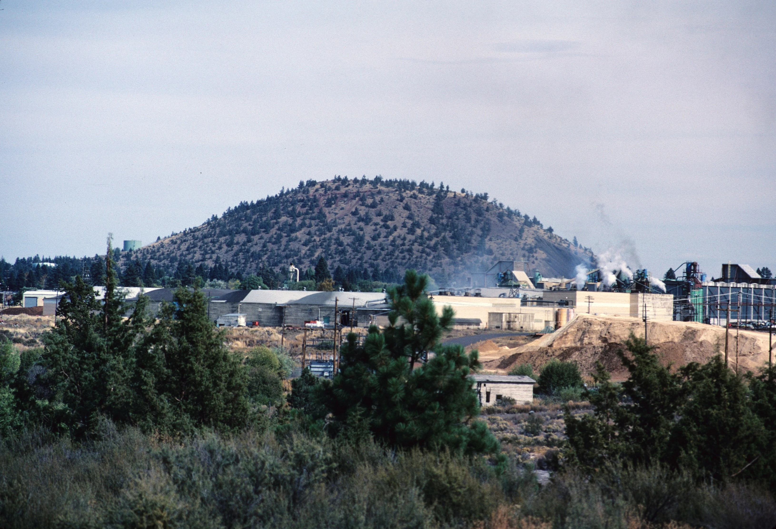

1984 photo of lumber mill and Pilot Butte
Other Bend-based companies[]
- 1859 Magazine
- American Licorice Company
- Bend Radio Group
- Breedlove Guitars
- Clear Catheter Systems
- Combined Communications
- Deschutes Brewery
- Edge Wireless
- Epic Aircraft
- Leverage Factory
- McMenamins Old St. Francis School
- Nosler, Inc.
- SCE Bend Studio
- Western Communications
Construction and real estate[]
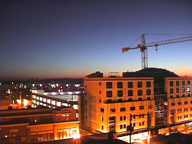

Downtown construction in Bend
According to the U.S. Department of Commerce's Bureau of Economic Analysis, in 2005 construction and real estate accounted for 17.3 percent of all jobs in the Bend metropolitan statistical area (MSA), which constitutes all of Deschutes County.[37] This figure is about 70 percent more than the proportion of construction and real estate jobs in the Oregon and national economies.[38] However, construction activity in Bend appears to be slowing - the number of building permit applications received by the Bend City Building Division fell from 826 in August 2006 to 533 in August 2007, a 35 percent decrease.[39]
A large influx of new residents drawn by Bend's lifestyle amenities, along with the low interest rates and easy lending that fostered a national housing boom in 2001−05, resulted in increased activity in Bend's construction and real estate sectors and have caused the rate of home price appreciation in Bend to grow substantially during that period.(citation needed) Median home prices in the Bend MSA increased by over 80% in the 2001−05 period.[40]
In June 2006, Money magazine named the Bend MSA the fifth most overpriced real estate market in the United States.[41] By September 2006, the Bend metro area ranked second in the list of most overpriced housing markets, and in June 2007 it was named the most overpriced housing market in America.[42][43]
The 2008−09 housing downturn had a strong effect on Bend's housing and economic situation. According to the Seattle Times,[44] single-family home prices dropped more than 40 percent from a peak of $396,000 in May 2007 to $221,000 in March 2009. Additional signs of the housing downturn include an April 2009 Deschutes county unemployment rate of 12.6 percent and in a tri-county area of Deschutes, Crook and Jefferson counties a 66 percent rise in homelessness from 2006 to 2,237.[44]
In May 2010 the Federal Housing and Finance Agency released a report in which Bend had the largest price drop in the country, 23 percent, from first quarter of 2009 to the first quarter of 2010.[45]
Museums and other points of interest[]
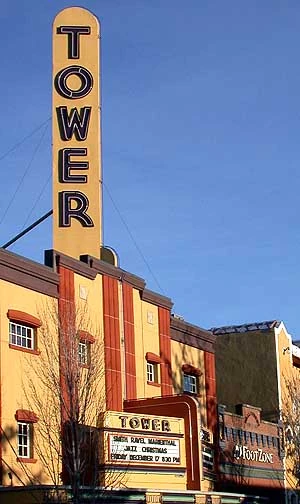
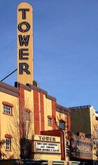
The historic Tower Theatre in downtown Bend.
- High Desert Museum
- Tower Theatre
- Deschutes Historical Museum
- Mirror Pond
Sports[]
Bend is home to the Bend Elks of the West Coast Collegiate Baseball League. The Elks play at historic Vince Genna Stadium. Bend is also the home of the Central Oregon Hotshots of the International Basketball League. The Central Oregon Steelheaders, continually one of the top teams in the NW conference of the Premier Arena Soccer League (PASL), play at the Central Oregon Indoor Sports Center in Bend.
Bend is the home of the professional cross-country ski team XC Oregon, which competes in races locally, regionally, nationally and internationally.[46]
Bend has had success in landing major sporting events such as the 2008 and 2009 USA Winter Triathlon National Championships, the 2008 and 2009 XTERRA Trail Running National Championships, and the 2009 and 2010 United States National Cyclo-cross Championships as well as the 2009 and 2010 USA Cycling Elite Road National Championships.
A popular spot for cycling, Bend has over 300 miles (480 km) of mountain bike trails and is the home to the Cascade Cycling Classic, the nation's longest running stage race for road bicycle racing. Bend was recently named the top mountain bike city in Mountain Bike Action magazine.
Bend features the Bend Roughriders RFC, a men's division 3 Rugby Football Club.[47]
Bend's Lava City Roller Dolls became a member of the Women's Flat Track Derby Association in April, 2009.[48]
Bend's Pole Pedal Paddle is one of the Pacific Northwest's premier athletic events. It is a relay race held each spring with six legs that include alpine skiing/snowboarding, cross-country skiing, biking, running, canoeing/kayaking and sprinting.
Bend is also home to the Deschutes County Rocks amateur boxing team.
Running is also a popular sport in Bend. Bend is home to the Haulin' Aspen Trail Marathon, XTERRA Trail Running National Championships, and the Pilot Butte Challenge. One of the largest running clubs in Bend is CORK (Central Oregon Running Klub). In 2006 Bend was named the best trail running city by Outside magazine,[49] because of 51 miles (82 km) of in-town trails.[50] Runners also enjoy parks such as Shevlin, Tumalo Falls, and Deschutes river trail.
Parks and recreation[]
- Newberry National Volcanic Monument
- Juniper Swim and Fitness Center [51]
- Pilot Butte State Park
- High Desert Museum
- Drake Park Neighborhood Historic District
- Camp Sherman
- Mount Bachelor ski area
- Oregon Badlands Wilderness

Farewell Bend Park
Education[]
The Bend area is served by Bend-La Pine Schools. There are four high schools (Bend High School, Marshall High School, Mountain View High School, and Summit High School), four middle schools, (Cascade Middle School, High Desert Middle School, Pilot Butte Middle School, and Sky View Middle School), 12 elementary schools, and four magnet schools. There are several private schools within the area as well, including Cascades Academy of Central Oregon, Seven Peaks, Waldorf School of Bend, St. Francis of Assisi, Morning Star Christian, and Trinity Lutheran [1]. Central Oregon Community College (COCC) and the OSU-Cascades Campus of Oregon State University (OSU) serve the community with both two- and four-year programs.
Media[]
- Newspapers
- Bend Bulletin
- Television
- KTVZ 21 (NBC)- The region's first broadcast TV station (launched in 1977).
- KFXO-LD 39 (FOX) - On April 17, 2006, the station launched a local news broadcast. The station later was purchased by KTVZ's parent firm, News-Press and Gazette Co.
- KOHD 51 (ABC) - Chambers Communications (Eugene, Oregon) recently purchased a broadcast license for the market and began its local newscasts in the fall of 2007.[52]
- KBNZ-LD (CBS) - Zolo Media, parent company of Bend Broadband, has purchased KBNZ. KOIN-TV Portland's news is offered with no local cut ins.
- NTVZ-CW (CW). KTVZ (DT2). Broadcast by NPG of Oregon, The CW carries popular entertainment programming. First local on-air broadcast was September 2006.
- KQRE-TM (Telemundo). Spanish language television broadcast by NPG of Oregon since 2007.
- COTV 11 - Carries RSN (Resort Sports Network), local events (parades, city council meetings, candidate forums). In addition, COTV airs local sports, including the Central Oregon Hotshots, Bend Elks, and local high school teams.
- Radio
AM[]
- KICE 940 AM - Bend Radio Group airs sports programming from ESPN Radio.
- KBND 1110 AM - News Talk Information format.
- KBNW 1340 AM - News Talk Information format.
FM[]
- KLBR 88.1 FM - National Public Radio and locally produced radio shows from Lane Community College. KLBR is a simulcast of KLCC (FM) in Eugene, Oregon.
- KWRX 88.5 FM - non-commercial classical music radio station broadcasting to the Bend, Oregon area. KWRX is a simulcast of KWAX in Eugene, Oregon.
- KPOV-FM 88.9 FM - Low-power community radio station owned by the Women's Civic Improvement League.
- KVRA 89.3 FM - Contemporary Christian format. Air 1.
- KVLB 90.5 FM - Contemporary Christian format. K-LOVE.
- KOAB-FM 91.3 FM - Oregon Public Broadcasting
- KRXF 92.9 FM - Bend Radio Group commercial modern rock music radio station in Sunriver Resort, with a slogan of "Local. Independent."
- KXIX 94.1 FM - Bend Radio Group commercial Top 40 music.
- KLTW-FM 95.7 FM - Adult Contemporary format.
- KNLR 97.5 FM - Contemporary Christian format.
- KTWS 98.3 FM - Classic rock format.
- KMTK 99.7 FM - broadcasts a country music format.
- KMGX 100.7 FM - Bend Radio Group Hot Adult Contemporary format
- KLRR 101.7 FM - commercial adult album alternative music radio station in Redmond, broadcasting to the Bend area.
- KSJJ 102.9 FM - Bend Radio Group country music format. Arbitron rated #1 station in the Bend market.
- KWPK-FM 104.1 FM - Hot Adult Contemporary format.
- KNLX 104.9 FM - Spanish Religious format.
- KQAK 105.7 FM - Classic Hits format.
- KWXS 107.7 FM - CHR-Rhythmic format.
Transportation[]
- Air
The nearest commercial airport is Roberts Field in Redmond, 18 miles (29 km) north. Horizon Airlines, SkyWest Airlines (flying as both United Express and Delta Connection) and Allegiant Airlines provide direct service to Portland, Seattle, Salt Lake City, San Francisco, Los Angeles, Las Vegas, and Mesa. The U.S. Forest Service operates an air base and training center for firefighting, and Butler Aircraft, a fixed-base operator, flies DC-4 aircraft for firefighting efforts.
Bend Municipal Airport (KBDN) is located 5 miles (8 km) northeast of the city and serves general aviation. Several significant general aviation companies are based at Bend Airport, including Precise Flight, which develops oxygen systems, speed brakes, landing lights and other modifications for general aviation aircraft, Epic Aircraft and Cessna.
- Bus
Template:Update The Bend Hawthorne Transit Center is a hub for the Cascades East Transit center with connections to intercity bus services including the High Desert Point, Eastern Point, and the Central Oregon Breeze.[53][54]
Bend was previously the only metropolitan area west of the Mississippi River without a public bus system. A measure that would have created a transit district was on the November 2004 ballot, but was defeated 53 to 41 percent. As of August 2006, however, funding was acquired and the B.A.T. (Bend Area Transit) bus service began on a limited basis. Buses have been running since September 27, 2006.[55]
During the Summer of 2007, not a single bus purchased was in operation (though several were due to weak A/C systems) and litigation was underway.[56]
- Highways
Bend lies at the intersection of U.S. Route 20 and U.S. Route 97. The latter runs on an expressway alignment through the city known as the Bend Parkway; a business route for US 97 runs along 3rd Street. The city is also served by the Century Drive Highway No. 372 which provides access to Mount Bachelor.
- Rail
A BNSF mainline runs north-south through the city; there are numerous spurs off of the mainline which serve industrial rail customers. The closest Amtrak service is in the town of Chemult, approximately 65 miles (100 km) to the south; this station is served by the Coast Starlight route.
Notable people[]
- Main article: List of people from Bend, Oregon
References[]
- ↑ 1.0 1.1 Template:Cite web
- ↑ Template:Cite web
- ↑ Template:Cite web
- ↑ Template:Cite web
- ↑ Template:Cite web
- ↑ Template:Cite web
- ↑ Template:Cite web
- ↑ Template:Cite web
- ↑ Template:Cite web
- ↑ Template:Cite web
- ↑ http://www.cascadebusnews.com/news-pages/business-a-industry/947-bends-new-sister-city-belluno-italy
- ↑ http://www.bendsistercityfoundation.org/
- ↑ Template:Cite web
- ↑ Template:Cite web
- ↑ Cite error: Invalid
<ref>tag; no text was provided for refs named2012 Pop Estimate - ↑ Template:Cite web
- ↑ Template:Cite web
- ↑ Template:Cite web
- ↑ 19.0 19.1 Template:Cite web
- ↑ File:Level IV ecoregions, Pacific Northwest.png
- ↑ Template:Cite web
- ↑ Template:Cite web
- ↑ Template:Cite web
- ↑ Template:Cite web
- ↑ 25.0 25.1 25.2 25.3 Cite error: Invalid
<ref>tag; no text was provided for refs namedNOAA - ↑ USNA - USDA Plant Hardiness Zone Map: North-West US
- ↑ National Water & Climate Center - Climate Information
- ↑ METROPOLITAN STATISTICAL AREAS AND COMPONENTSTemplate:Dead link, Office of Management and Budget, 2007-05-11. Accessed 2008-08-01.
- ↑ MICROPOLITAN STATISTICAL AREAS AND COMPONENTSTemplate:Dead link, Office of Management and Budget, 2007-05-11. Accessed 2008-08-01.
- ↑ COMBINED STATISTICAL AREAS AND COMPONENT CORE BASED STATISTICAL AREASTemplate:Dead link, Office of Management and Budget, 2007-05-11. Accessed 2008-08-01.
- ↑ Template:Cite web
- ↑ Template:Cite web
- ↑ Template:Cite web
- ↑ Bend Film Festival
- ↑ Oregon SolutionsTemplate:Dead link
- ↑ EDCO
- ↑ BEA : Local Area Personal Income
- ↑ Economy endures in housing slump | The Bulletin
- ↑ Welcome to the City of Bend Oregon Website - Statistics - Building Division
- ↑ Template:Cite news
- ↑ Template:Cite news
- ↑ Template:Cite news
- ↑ Template:Cite news
- ↑ 44.0 44.1 Template:Cite news
- ↑ Template:Cite news
- ↑ XC Oregon
- ↑ Bend Rugby
- ↑ Template:Cite web
- ↑ Template:Cite web
- ↑ Template:Cite web
- ↑ http://www.bendparksandrec.org/Juniper_Swim__Fitness
- ↑ Template:Cite web
- ↑ Template:Cite web
- ↑ Template:Cite web
- ↑ Template:Cite news
- ↑ Template:Cite news
External links[]
Template:Portal Template:Commons category Template:Wikivoyage
- Entry for Bend in the Oregon Blue Book
- Bend Chamber of Commerce
- Visit Bend (aka Bend Visitor and Convention Bureau
| ||||
| Crook County | Forest Crossing • O'Neil • Paulina • Post • Powell Butte • Prineville • Roberts • Suplee | |||
| Deschutes County | Alfalfa • Bend • Black Butte Ranch • Brothers • Cloverdale • Deschutes River Woods • Eagle Crest Resort • Hampton • La Pine • Millican • Redmond • Sisters • Sunriver Resort • Terrebonne • Three Rivers • Tumalo | |||
| Jefferson County | Ashwood • Camp Sherman • Crooked River Ranch • Culver • Gateway • Geneva • Grandview • Grizzly • Horse Heaven • Kilts • Madras • Metolius • Opal City • Warm Springs Indian Reservation • Willowdale | |||
| Parts of this article were written using Creative Commons Licensed content from Wikipedia. |
| See the original article(s) here: Bend, Oregon |